
Northern Mississippi, Alabama, and Southwest Georgia Face Flash Flooding Threat as Training Thunderstorms Bring 2 to 3 Inches of Rain Per Hour
TUSCALOOSA, ALABAMA — A mesoscale precipitation discussion issued Saturday is warning of flash flooding across Northern Mississippi, Alabama, and Southwest Georgia as training thunderstorms repeatedly move over the same areas through the region.
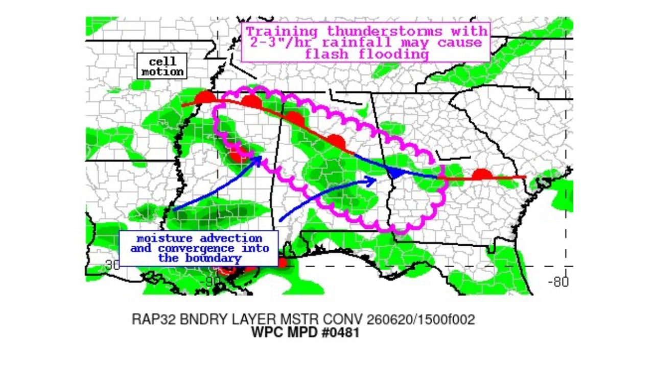
Training Storms Could Bring 2 to 3 Inches of Rain Per Hour
According to the discussion, thunderstorms are expected to train, or repeatedly track over the same corridor, producing rainfall rates of 2 to 3 inches per hour. Forecasters warned that this repeated heavy rainfall may cause flash flooding across the highlighted zone as the storms continue to develop and move along a defined boundary.
Moisture Advection and Convergence Fueling Storm Development
The discussion points to moisture advection and convergence feeding into a boundary stretching across the region as the primary driver behind the developing storms. Arrows on the outlook map show southerly moisture transport converging along the boundary, helping fuel the repeated rounds of heavy rainfall.
Threat Area Spans Across Three States
The highlighted zone stretches across Northern Mississippi, much of Alabama, and into Southwest Georgia, with the boundary and associated storm cells tracking roughly along a line cutting through the heart of the affected region. The discussion is based on RAP32 boundary layer moisture convergence data, used by forecasters to identify areas at the greatest risk for training storms and localized flash flooding.
Residents Urged to Stay Weather Aware
With the potential for fast-developing flash flooding, residents across the affected parts of Mississippi, Alabama, and Georgia are advised to monitor local forecasts and avoid low-lying or flood-prone areas as the storms move through.
For more stories like this, visit our website regularly for the latest updates.