
Florida Faces Sporadic Damaging Wind Gusts Up to 60 MPH From Orlando to Miami Through Late Afternoon
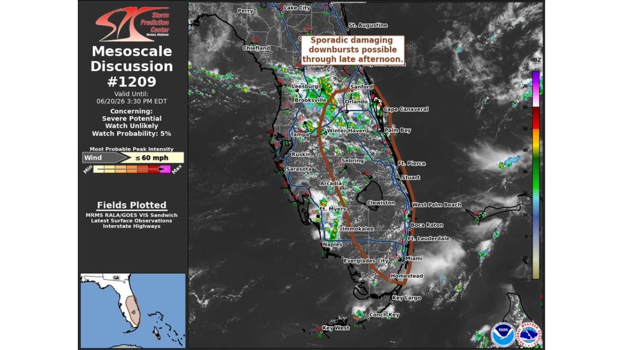
ORLANDO, FLORIDA — A mesoscale discussion issued Saturday afternoon is warning of sporadic damaging downbursts possible through late afternoon across a wide stretch of the Florida peninsula. The discussion, valid until 3:30 PM EDT, covers an area stretching from near Orlando and Sanford south through Sarasota, Arcadia, Naples, and Fort Lauderdale.
Damaging Wind Gusts Possible Up to 60 MPH
According to the discussion, the most probable peak intensity for the threat involves wind gusts up to 60 mph. While a severe thunderstorm watch is currently considered unlikely, with a probability listed at just 5 percent, forecasters noted that severe potential remains a concern as storms continue developing through the afternoon.
Threat Zone Stretches Across Central and South Florida
The outlined area cuts a corridor through the central and southern parts of the state, passing near Leesburg, Brooksville, Winter Haven, Sebring, Lake Wales, Stuart, West Palm Beach, Boca Raton, and Miami, before tapering off near Homestead. Cities along both coasts, including Tampa, Fort Myers, and Cape Canaveral, sit just outside the highlighted zone but remain close enough that conditions could still shift.
Forecasters Continue Monitoring Storm Development
The discussion is based on a combination of radar data, satellite imagery, surface observations, and interstate highway mapping used to track storm movement in real time. Forecasters are expected to continue monitoring the situation as storms develop through the late afternoon hours, with updates likely as conditions evolve.
For more stories like this, visit our website regularly for the latest updates.